
Finding Secret Fishing Locations
Finding secret fishing spots has gotten complicated with all the GPS mapping, social media oversharing, and crowdsourced fishing apps flying around. As someone who’s built a mental database of productive spots over thirty years, I learned everything there is to know about discovering and protecting quality fishing locations. Today, I will share it all with you.
Study Maps First
Topographic maps show structure underwater that you can’t see from the surface—points, drop-offs, creek channels, and depth changes. Google Earth reveals access roads and shoreline features that indicate where you can actually get to the water. Study the maps before you drive anywhere and waste gas on spots you can’t access.
Look for features that concentrate fish in predictable patterns: where creeks enter lakes bringing food and oxygen, points that extend into deeper water creating current breaks, isolated structure in otherwise featureless areas where fish have no choice but to hold. These features are permanent and fish use them year after year.
Nautical charts work even better for larger water bodies, showing depth contours and bottom composition that topographic maps miss. Many are available free online through NOAA for coastal waters and major lakes.
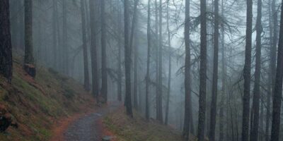
Walk the Banks
Explore on foot instead of just fishing from the parking lot like everyone else. Overgrown access points that cars can’t reach often mean less fishing pressure and more fish. Small creeks feeding larger waters can be gold mines that nobody fishes because they don’t look impressive enough to bother with.
Look for signs of fish activity beyond just seeing fish jump—baitfish jumping, birds diving, surface disturbance in specific areas all indicate feeding fish. Also look for signs of other anglers—worn paths usually lead somewhere worth going, even if you need to walk farther to find less pressured water.
Bring polarized sunglasses and spend time observing before casting. You’ll see structure, fish movement patterns, and depth changes that weren’t obvious initially. Probably should have led with this section, honestly—scouting time is never wasted.
Talk to Locals
Bait shops know what’s biting where because their business depends on customers catching fish. So do dock workers, park rangers, and old-timers sitting on benches who’ve fished the area for decades. Most fishermen love talking about fishing and will share general information readily. Just don’t ask for their exact spot coordinates—that’s fishing etiquette violation.
Buy something while you’re gathering information. Shop owners are understandably more helpful to paying customers than people just pumping them for free intel. A few dollars in tackle purchases buys goodwill and better information.
Listen more than you talk. People reveal productive patterns and locations when they’re telling stories about catches, not when you’re interrogating them with direct questions.
Try Unpopular Times
Weekday mornings when everyone else is working. Bad weather days when conditions are fishable but uncomfortable enough to keep crowds away. The shoulder seasons before and after peak tourist times when fish are less pressured. Good spots that are crowded on weekends might be completely empty on a Wednesday.
Night fishing opens up entire water bodies that see heavy daylight pressure. Many species feed more aggressively after dark when they feel safer from predators, both above and below the water.
Early spring and late fall see fewer anglers but can offer excellent fishing. You’ll deal with weather challenges, but you gain uncrowded access to quality spots.
Look for Overlooked Water
Farm ponds, subdivision retention ponds, and small municipal lakes often hold surprising fish because they receive little pressure. Many property owners will grant permission if you ask politely and respect their land. Some of my best bass fishing happens in ponds you’d drive past without noticing.
Tailwaters below dams concentrate fish but get crowded. Hike upstream or downstream beyond where most anglers stop. The fishing often improves dramatically once you escape the crowd.
Urban areas have fishing opportunities that locals ignore. City parks, industrial canal systems, and water treatment outflows can be shockingly productive because most anglers assume they’re not worth fishing.
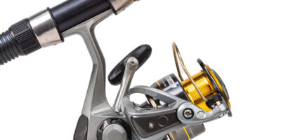
Use Electronics Strategically
Fish finders help you understand underwater terrain and locate fish concentrations quickly. Use them to identify productive structure, then fish it thoroughly instead of constantly moving. The best anglers use electronics to learn, not as a crutch.
GPS lets you mark productive spots precisely so you can return. Mark not just where you caught fish, but also structure, depth changes, and vegetation edges that might produce during different seasons or conditions.
Side-scan sonar shows structure extending out from your boat path, revealing offshore structure that traditional sonar misses. It’s particularly useful for locating isolated cover in large areas of featureless bottom.
Keep Records
Mark productive spots on a personal map or GPS with enough detail to remember why they were productive. Note conditions, time of year, what worked, and what didn’t. Over years, you build a database of reliable locations for different seasons and species that becomes incredibly valuable.
Include weather conditions, water temperature, and successful techniques in your notes. Patterns emerge when you have years of data showing that certain spots produce consistently under specific conditions.
Photograph landmarks from the water so you can relocate spots without GPS. Electronics fail, but recognizing that distinctive tree line or building helps you find your spot even when technology quits.
Pay Attention to Patterns
Fish behavior follows patterns that apply across multiple water bodies. If you find bass relating to submerged timber in one lake, check similar structure in other lakes. If current seams produce in one river, they’ll likely produce in others. Learning patterns is more valuable than memorizing individual spots.
Seasonal movements happen predictably. Fish move shallow to spawn, suspend during summer stratification, and follow baitfish migrations in fall. Understanding these patterns helps you locate fish even on unfamiliar waters.
That’s what makes spot-finding endearing to us anglers—it’s this combination of detective work, pattern recognition, and exploration that makes you better over time.
Explore During Low Water
Drought conditions and winter drawdowns expose structure that’s invisible when water levels are normal. Walk the exposed lake bed noting stumps, rock piles, old roads, and creek channels. When water returns, you’ll know exactly where structure is located while other anglers fish blindly.
Take photos and GPS coordinates of exposed structure. What you learn during low water pays off for years during normal conditions when that structure is submerged but still holding fish.
Network Strategically
Join fishing clubs and online forums, but be selective about what you share publicly. Build relationships with a few trusted anglers who fish similar waters. Trading information with reliable partners who respect spot confidentiality benefits everyone.
Fishing tournaments reveal productive patterns even if exact spots remain secret. Watch where top anglers launch and which general areas produce winning bags. You won’t get precise locations, but you’ll learn which sections of the lake are most productive.
Respect Private Property
Many great spots are on private land requiring permission to access. Ask property owners politely, explain you’ll respect their property, and actually follow through on your promises. Most landowners are reasonable if you demonstrate you’re trustworthy.
Leave access points cleaner than you found them. Close gates, pack out trash, and don’t park where you’ll block access. One thoughtless angler can ruin access for everyone when a property owner gets tired of dealing with problems.
Protect What You Find
Secret spots stop being secret when you post them online with GPS coordinates and photos. Keep the good ones to yourself or share only with trusted friends who’ll do the same. Social media has burned out countless productive spots by attracting crowds that love them to death.
Be vague when discussing productive spots publicly. “I caught fish in the north end” protects a spot better than “Here are coordinates to the submerged log pile.” Share knowledge about techniques and patterns without revealing exact locations.
The best spots took time and effort to find. Giving them away freely to people who haven’t put in that work devalues your investment and ruins the fishing for everyone through overcrowding.
Be Willing to Fail
Most exploration trips produce little fishing success initially. You’ll fish blank water, access spots that looked promising but aren’t, and waste time on dead ends. Accept that as the cost of finding quality locations. Every successful spot-finder has explored dozens of duds for every keeper spot they found.
Treat exploration as its own reward instead of viewing it as wasted fishing time. The knowledge you gain from unsuccessful trips still teaches you about water types and structure that don’t hold fish, which helps you eliminate similar areas faster in the future.
Revisit and Refine
A spot that doesn’t produce today might be excellent under different conditions. Revisit locations during different seasons, water levels, and times of day before writing them off completely. Some of my most reliable spots produced nothing on first visit but became favorites once I understood when and how to fish them.
Refine your approach on productive spots. If you catch fish in an area, expand your search to similar nearby structure. Often the spot you found is just one of several productive areas in close proximity.
Finding secret fishing locations requires persistence, observation skills, and willingness to explore beyond the obvious spots. The effort pays off in uncrowded fishing and consistent success that separates you from anglers who just fish wherever is convenient.


Stay in the loop
Get the latest fish blog updates delivered to your inbox.